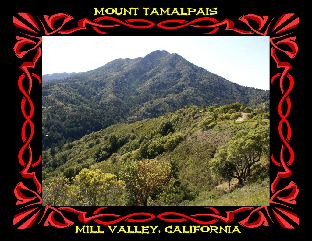
MOUNT TAMALPAIS- “HIKING PARADISE”

MAJESTIC MT. TAMALPAIS AS SEEN FROM BLITHEDALE RIDGE. PHOTO BY BEN UPHAM.
CLICK THE LINK BELOW TO SEE MORE MOUNT TAMALPAIS PHOTOS & ARTWORK BY BEN UPHAM III:
MT. TAMALPAIS PHOTOS & ARTWORK
MOUNT TAMALPAIS
“HIKING PARADISE EXISTS IN SAN FRANCISCO BAY AREA”
BY A. H. ROGERS
THE JOPLIN GLOBE
JOPLIN, MISSOURI JULY 3, 1971
MOUNT TAMALPAIS STATE PARK, CALIFORNIA –
Mountains, forest and redwood groves with spectacular views of San Francisco Bay and the Pacific Ocean and all right in the midst of the thickly populated, highly urbanized San Francisco-Oakland- Marin County area — this may sound too good to be true. Yet all too true it is in this gem of the California State Park System.
Mount Tamalpais contains 1500 acres adjoining beautiful Muir Woods National Monument and only a few miles north of the Golden Gate Bridge and San Francisco, but one can still find spots on its woodland trails where no sound but the singing of birds and the rushing of mountain streams may be heard. In summer, fogs off the Pacific often furnish natural air conditioning for this jewel of the California Coastal Range. Nevertheless, when these fogs lift, beauty lies in all directions.
Down below may be seen the blue bay and ocean, the green and golden hills and the glistening cities. On rare occasions one can view a panorama that stretches from the Farallon Islands 25 miles out in the Pacific on the west to the Sierras 200 miles distant in the East.
Moreover, this park is a hiker’s paradise. Some 28 miles of hiking trails are found within its boundaries, and these connect with another 200 miles of trails that wander through adjoining Muir Woods and its towering groves of coastal redwoods as well as through the hills forming the watershed of the Marin Municipal Water District.
One of the longer routes is the Dipsea Trail, a hilly six-miles plus between the towns of Mill Valley and Stinson Beach and the scene in August is an annual footrace involving athletes from six to sixty. Naturally enough, residents of the surrounding cities have been flocking to Mount Tamalpais for years. In the early part of this century they utilized a crooked and winding railroad, now abandoned, or an old toll road. Now they come on free but narrow and winding state highways to enjoy the campgrounds and picnic areas or to roam the network of trails on foot or on horseback. Mount Tamalpais is one of those all too rare recreation areas whose preservation is
beyond any material price.
CLICK THE LINKS BELOW TO SEE MT. TAMALPAIS PHOTOS & ARTWORK BY BEN UPHAM III:
MT. TAMALPAIS PHOTOS & ARTWORK